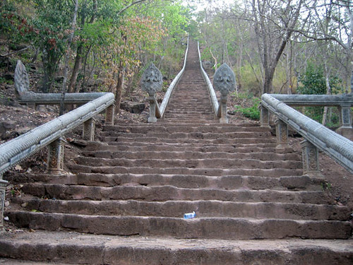
During the pre-Angkor and Angkor eras, the areas to the north and to the north west of the Tonle Sap Lake were known as the territories of Amogha Boreak and Bhima Boreak. During the Angkor period, the territory of Amogha Boreak was significantly prosperous because the land was so fertile that rice crops, fruit and vegetables produced excellent yields. Many Khmer people settled there as indicated by the existence of so many ancient temples in the area. With the exception of the temples of Wat Banan, Ek Phnom, Baseth, Stung, Banteay Tey, Banteay Chmar, etc.,other monuments, which were built by dignitaries and subjects at the time as places of worship to God and other deities of Buddhism and Hinduism, almost completely disappeared.
Between the 15th century and the 18th century the area was invaded by the Siamese army, forcing landowners off their land and splitting up their families.
From the late 18th century until early in the 20th century, the Siamese ruled Battambang and placed it under the rule of the Lord Chaofa Ben family, which was later known as the Akpheyyavong Family. This lasted for 6 generations and ended in 1907. While under Thai rule, the province was a changwat of Thailand called Phra Tabong.
The French Siamese Treaty of March 23, 1907, obliged the Siamese to return territories that they had occupied for more than a century. These included Battambang, Siem Reap and Angkor, in exchange for Trat province and the area of Dach Se (Lao territory) in the upper catchment area of the Mekong River. On December 6, 1907, His Majesty Preah Bat Sisowath issued a royal declaration splitting Battambang into 3 provinces: Battambang, Siem Reap and Serei Sophorn. In 1925, Battambang was divided again into two provinces: Battambang and Siem Reap, with Battambang having two districts: Battambang and Serei Sophorn. By 1940, Battambang consisted of 7 districts: Battambang, Sangke, Maung Russey, Monkol Borei, Toeuk Cho, Serei Sophorn, and Bei Thbaung.
In May 1953, the Poi Pet administration was founded and ordered under the district of Serei Sophorn which was divided into two districts: Serei Sophorn and Banteay Chmar. In March 1965, the administration of Poi Pet, was elevated to the status of a district named O Chrov. In July 1965, part of the territory of Maung Russey was separated to become the administration of Kors Kralor. In March 1966, another new district Thmar Pouk was founded and the district of Banteay Chmar was cut off from the province of Battambang for incorporation into Oddor Meanchey province, another newly founded province. In the early years of the Khmer Rouge, two new districts were established: Banan and Kors Lor. During the 3 years and 9 months of the Killing Fields, Battambang saw its people evacuated by Pol Pot's men from the city and towns and relocated to remote and mountainous areas. The province of Battambang, once known as the rice bowl of the country, was turned into a site of torture, killings, and starvation.
The province of Battambang was completely liberated from the genocidal regime on January 13, 1979. At that time, the People’s Committee of commune-Sangkat was founded through the first-ever elections in 1983. Between 1979 and 1986, Battambang had 9 districts and one provincial town.
In 1986, three new districts were created: Banan, Bovel, and Ek Phnom. Until that point, Battambang had 12 districts and 1 provincial town. In 1988, however 5 districts were separated and incorporated into the newly founded province of Banteay Meanchey.
In 1998, following the integration of the remaining territory of the former Democratic Kampuchea, the province of Battambang saw part of its territory separated for the municipality of Pailin, while 4 new districts were established: Samlot, Kamreang, Phnom Proeuk and Sampov Loun. In 2000, part of the district of Maung Russey was split off to become the district of Koas Krala.[3]


0 comments:
Post a Comment